
Foto: Mariëtte van Lit-Pieterse

Start op het Plein. Langs de Dorpskerk over de Duinrellweg naar de ingang van Duinrell. Steek de Storm van ’s Gravesandeweg over richting kassa Duinrell. Meteen links staat tussen het groen het Duitse Huis, (2) (Storm van ’s Gravensandeweg 155) een traditioneel vormgegeven huis dat hier in opdracht van de Duitsers tijdens de oorlog is gebouwd. Het diende ter beveiliging van de ingang van het landgoed Duinrell, waar in het (in 1986 afgebroken kasteel Duinrell) commissaris-generaal dr. Friedrich Wimmer woonde. Hij was een soort minister van justitie, volksgezondheid en onderwijs.
Terug naar de Storm van ’s Gravesandeweg. Links af, bij stoplichten links af de Katwijkseweg in. Bij rotonde rechtdoor, omhoog de Wassenaarse Slag op. Deze helemaal volgen tot de rotonde bij het strand. Richting strandopgang staat het monument voor gesneuvelde Franse commando’s. In februari 1944 werden zes geallieerde commando’s vanuit zee bij de Wassenaarse Slag gedropt om verkenningen uit te voeren. Deze actie liep tragisch af met de dood van alle manschappen. Links staat het restaurant De Badmeester. (3) (Wassenaarse Slag 15) Het is gebouwd op een grote bunker die onderdeel was van de Atlantikwall, de verdedigingslinie tegen de geallieerden die zich uitstrekte langs de kust van Noorwegen tot Spanje.
Het fietspad door de duinen weer terugrijden richting dorp. Meteen rechts ligt de Vleermuisbunker. (4) (Wassenaarse Slag 33) Deze is alleen op speciale dagen met een rondleiding te bekijken (raadpleeg de website). Fietspad vervolgen. Bij rotonde naar links, richting Katwijk. Bij de volgende rotonde vinden we het bloembollenbedrijf Overdevest. (5) (Katwijkseweg 19a) In de oorlog lagen er achter de boerderij nog uitgestrekte bollenvelden. Tijdens de Hongerwinter van 1944/45 was er bijna geen voedsel meer te krijgen en aten veel mensen noodgedwongen tulpenbollen.
Bij de rotonde rechts af, de Kokshornlaan op. Aan het eind van deze weg vóór de bocht naar links, de Oostdorperweg in. Eerste weg links afslaan, de Ruigelaan in. Aan het eind van deze doodlopende weg komen we bij het voormalige Vliegveld Valkenburg. (6) Tijdens de meidagen van 1940 landden hier Duitse vliegtuigen vol soldaten en werden hier parachutisten gedropt om het vliegveld te veroveren. Er ontstonden zware gevechten met Nederlandse militairen, die enkele dagen aanhielden. De boerderij aan het eind van deze weg, aan de rand van het vliegveld, werd tijdens beschietingen volledig verwoest. De resten werden na de oorlog opgeruimd en in 1947 werd hier een nieuwe boerderij gebouwd. Deze boerderij is onlangs gesloopt en opnieuw opgebouwd; alleen de gevelsteen stamt nog uit 1947.
Keer terug naar de Oostdorperweg, links af. Deze weg gaat met een bocht over in de Hogeboomseweg. Na een bocht naar links direct afslaan naar rechts, het Ammonslaantje in. Aan het eind van dit weggetje rechts de Deijlerweg in. Je rijdt nu op het tracé van de Gele Tram, tijdens de oorlog de verbinding tussen Leiden, Wassenaar en Den Haag.
Voorbij de rotonde de Deijlerweg vervolgen. Vóór de ruime bocht naar rechts, links de Lus in. Aan de rechterhand ligt een grote zwerfkei uit Overijssel, het bevrijdingsmonument (7) dat hier in 1946 is geplaats en dat 5 mei 1940 herdenkt. Links aanhouden tot aan de ventweg langs de Rijksstraatweg, rechtsaf langs de Rijksstraatweg. Deze weg kort stuk na het stoplicht vervolgen, dan meteen rechtsaf de Raadhuislaan in. Meteen links, op de hoek Rijksstraatweg/ Raadhuislaan staat de vroegere portierswoning annex theekoepel (8) (Raadhuislaan 1a) van De Paauw. De Duitsers maakten aan de kant van de Rijksstraatweg een grote horizontale opening in de keldermuur. In de kelder werd een kanon geplaatst dat een deel van de Rijksstraatweg in noordelijke richting kon bestrijken. Het werd bediend door zes Duitse militairen. De opening is na de oorlog dichtgemetseld, zodat er nu niets meer van te zien is. Iets verderop in de Raadhuislaan staat rechts huize Klim Op, (9) (Raadhuislaan 4). Dit was een rusthuis voor Joodse ouderen. In 1942 en 1943 moesten alle bewoners op last van de bezetter het tehuis verlaten, waarna ze werden afgevoerd naar de vernietigingskampen. In de bestrating liggen sinds 2023 vier Stolpersteine of struikelstenen, kleine vierkante stenen met een messing plaatje waarop de namen staan van in de oorlog omgebrachte Joden die in huize Klim Op gewoond hebben. Sinds 2021 zijn in Wassenaar enkele tientallen van deze struikelstenen geplaatst.
Verderop aan de Raadhuislaan staat Raadhuis De Paauw (10). Tijdens de bezetting kreeg Wassenaar een ‘foute’ burgemeester, dat wil zeggen: een prominent lid van de NSB (die bovendien met de Duitsers samenwerkte). Veel Wassenaarse gemeenteambtenaren waren neutraal, sommige ‘fout’ en een enkeling nam deel aan het verzet. Als herinnering aan gemeenteontvanger Geesbert van Barneveld, die deelnam aan het verzet en Joodse onderduikers hielp, is in zijn vroegere werkkamer in De Paauw een plaquette aangebracht en bovendien is het park langs de Hofcampweg naar hem vernoemd. Van Barneveld stierf in 1944 in een concentratiekamp, 36 jaar oud.
Ga links om het raadhuis heen, het bruggetje over, en volg de Landgoederenroute die met bordjes is aangegeven. Vanaf de Laan van Hoogwolde kun je rechts in de verte het kasteel Oud Wassenaar (Park Oud Wassenaar 1) zien. In dit hotel verbleven tijdens de bezetting veel hoge Duitse officieren. Ook de rijkscommissaris voor het bezette gebied dr. Arthur Seyss-Inquart verbleef hier korte tijd aan het begin van de oorlog.
Volg de Landgoederenroute verder. Je passeert, even na de Teylingerhorstlaan, in het bos het kasteel De Wittenburg. Hier was een montageplaats voor het V2-wapen. De V2’s waren ongeveer 14 meter lange raketten met een explosieve lading die vanaf een mobiel lanceerplatform door de Duitsers aan het eind van de oorlog werden afgevuurd richting Londen.
De landgoedereroute eindigt bij de Zijdeweg. Hier linksaf, daarna rechtsaf langs de Rijksstraatweg richting Den Haag. Rechts liggen weilanden en daarachter het landgoed Duindigt. Ook vanuit dit bosrijke gebied lanceerden de Duitsers V2’s richting Londen. Om deze lanceringen te verhinderen bombardeerden geallieerde vliegtuigen het gebied. Het landhuis op Duindigt werd totaal verwoest, evenals de boerderij en diverse dienstwoningen.
Vervolg het fietspad richting Den Haag, langs de Benoordenhoutseweg. Neem, aangekomen bij de bebouwing, de tweede straat rechts, de Laan van Clingendael. Steek de Wassenaarseweg over en wandel over de brede oprijlaan van het landgoed Clingendael. Ter hoogte van het landhuis staat links een wat kleiner gebouw. Aan dit herbouwde koetshuis is een plaquette aangebracht. Deze herinnert aan het verhoor van twee gevangenen van het ‘Oranjehotel’ (de strafgevangenis in Scheveningen) door SS-leider Heinrich Himmler dat hier in 1942 plaatsvond. In het landhuis Clingendael woonde tijdens de bezetting rijkscommissaris Arthur Seyss-Inquart. Hij was de hoogste gezagsdrager in het door de Duitsers bezette Nederland.
Ga terug over de brede oprijlaan en sla aan het eind linksaf, de Wassenaarseweg op. Houd links aan en ga het fietspad op. Het gebouw met het hoge dak links is de als boerderij vermomde commandobunker van Seyss-Inquart. (11) In tijden van gevaar kon de rijkscommissaris zich hier verschansen. Hier tegenover, rechts van het fietspad, staat de voormalige Julianakazerne (nu opgedeeld in appartementen) (Therese Schwartzstraat 15 Den Haag) . Deze kazerne is in de oorlog op last van de Duitsers gebouwd voor huisvesting van de SS, die onder andere voor de beveiliging van de rijkscommissaris zorgde. Met zijn hoektorentjes geeft deze kazerne de indruk van een kasteel.
Volg het fietspad verder richting Wassenaar. Het fietspad gaat na de brug over in de Van Brienenlaan, die je afrijdt. Aan het eind naar links de Waalsdorperlaan op. Achter het open veld rechts ligt de Renbaan Duindigt. Aan het eind van de bezetting was de renbaan een van de locaties waar geallieerde vliegtuigen met toestemming van de Duitsers in april 1945 voedselpakketten uitwierpen. De toen heersende hongersnood kon hiermee iets verlicht worden.
De Waalsdorperlaan vervolgen, bij eerste kruispunt rechtsaf, de Buurtweg op. Deze weg helemaal affietsen. Links in de verte ligt het Engelse landhuis Voorlinden (Buurtweg 90) aan een open veld, met bos op de achtergrond. Tijdens de bezetting was het in gebruik als herstellingsoord voor gewonde Duitse militairen.
De Buurtweg eindigt even voorbij een grote witte portierswoning. Aan het eind van de Buurtweg naar rechts en direct, bij het stoplicht, naar links de Groot Haesebroekseweg op. Het bos links is het eeuwenoude landgoed Groot Haesebroek. (Groot Haesebroekseweg 44) In het (niet zichtbare) landhuis woonde de Luftwaffe-generaal Friedrich Christiansen. Hij was de hoogste militaire gezagsdrager van het bezette Nederland.
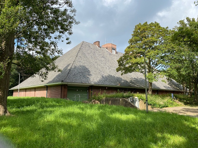
De eerste weg rechts, de Nachtegaallaan in, aan het eind naar links, de Schouwweg op. Rechts ligt het wooncomplex WAVO-park. (12) (Schouwweg 81) Hier stond tijdens de meidagen van 1940 luchtdoelgeschut op het dak. Duitse vliegtuigen probeerden dit geschut te bombarderen. Daarbij raakte het gebouw beschadigd en kwam een bewoner om het leven.
Verderop aan de Schouwweg is rechts het oorlogsmonument met het beeld Stervende strijder van Joop M. Veldheer. Dit beeld stond oorspronkelijk sinds 1952 op de in 1940 ingerichte oorlogsbegraafplaats ‘Het Lange Duin’ aan de andere kant van de weg. Deze begraafplaats is in 1982 opgeheven en de stoffelijke overschotten zijn naar andere oorlogsbegraafplaatsen overgebracht.
Verderop naar links, de Koekoekslaan in. Bij het eerstvolgende kruispunt staat het monumentje ter herinnering aan de eerste twee V-2’s die de Duitsers op 8 september 1944 afvuurden richting Londen. Eén V-2 steeg vanaf deze locatie op, de andere werd gelanceerd op de hoek Schouwweg/ Rust en Vreugdlaan.
Omkeren, terug naar de Schouwweg. Linksaf, de Schouwweg tot het eind volgen. Het grote kruispunt oversteken dan schuin naar links de Kerkstraat in. Verderop staat rechts, na de Sint Willibrorduskerk, aan een parkeerterrein cultureel centrum Warenar. Dit voormalige patronaatsgebouw diende sinds november 1942 als Wehrmachtsheim, een ontspanningsoord voor Duitse militairen.
Volg de Kerkstraat verder. Deze gaat over in een voetgangersgebied. Steek wandelend de Langstraat over, schuin naar links de Achterweg in. Daarna de eerste straat links, de Schoolstraat in. Rechts staat het witte herenhuis Neyenburgh. (Schoolstraat 27) Dit diende later tijdens de bezetting als gemeentehuis, toen Raadhuis De Paauw was gevorderd door de Duitsers.
Rij de Schoolstraat verder uit naar het Plein, waar de fietstocht begon. Op de hoek van het Plein (nummer 2) en de Duinrellweg staat een zeventiende-eeuws huis dat tijdens de bezetting diende als distributiekantoor. Om in tijd van schaarste kleding en voedsel eerlijk te verdelen, gaf de gemeente bonnen uit. Alleen door het inleveren van een bepaalde bon aan de winkelier kon je de op de bon vermelde goederen kopen.
Hier eindigt de fietstocht. Nog een fijne dag gewenst!
Bike route through Wassenaar along memories of World War II (length approx. 28 km)
Photo: Mariëtte van Lit-Pieterse

Start at the Plein. Pass the Dorpskerk on the Duinrellweg to the entrance of Duinrell. Cross the Storm van ’s Gravesandeweg in the direction of the Duinrell ticket office. Immediately on the left stands among the greenery the German House, (2) (Storm van ’s Gravensandeweg 155) a traditionally designed house built here by order of the Germans during the war. It served to secure the entrance to the Duinrell estate, where Commissioner General Dr. Friedrich Wimmer lived in the Duinrell Castle (demolished in 1986). He was a kind of minister of justice, public health and education.
Return to the Storm van ’s Gravesandeweg. Turn left, turn left at traffic lights into Katwijkseweg. At traffic circle straight ahead, up the Wassenaarse Slag. Follow this all the way to the traffic circle at the beach. Towards the beach entrance is the monument to fallen French commandos. In February 1944, six Allied commandos were dropped from the sea at the Wassenaarse Slag to carry out reconnaissance missions. This action ended tragically with the death of all the men. On the left is the restaurant De Badmeester. (3) (Wassenaarse Slag 15) It is built on a large bunker that was part of the Atlantic Wall, the line of defense against the Allies that stretched along the coast from Norway to Spain.
Ride the bike path through the dunes back toward the village. Immediately on the right is the Bat bunker. (4) (Wassenaarse Slag 33) This can only be viewed on special days with a guided tour (consult the website). Continue along the bike path. At traffic circle turn left, direction Katwijk. At the next traffic circle we find the bulb farm Overdevest. (5) (Katwijkseweg 19a) In the war there were still extensive bulb fields behind the farm. During the 1944/45 winter of hunger there was almost no food available and many people were forced to eat tulip bulbs.
At the traffic circle, turn right onto Kokshornlaan. At the end of this road before the curve to the left, turn into the Oostdorperweg. Take the first road to the left, into Ruigelaan. At the end of this cul-de-sac we come to the former Vliegveld Valkenburg. (6) During the May days of 1940 German planes full of soldiers landed here and paratroopers were dropped to capture the airfield. Heavy fighting with Dutch soldiers ensued and lasted for several days. The farm at the end of this road, on the edge of the airfield, was completely destroyed during shelling. The remains were cleared after the war and a new farm was built here in 1947. This farm was recently demolished and rebuilt; only the facade stone still dates from 1947.
Return to Oostdorperweg, turning left. This road curves into the Hogeboomseweg. After a left turn, immediately turn right into the Ammonslaantje. At the end of this road turn right into the Deijlerweg. You are now on the route of the Yellow Tram, during the war the connection between Leiden, Wassenaar and The Hague.
Past the traffic circle, continue along the Deijlerweg. Before the wide right turn, turn left into the Lus. On your right is a large boulder from Overijssel, the liberation monument (7) placed here in 1946, commemorating May 5, 1940. Keep left until you reach the service road along Rijksstraatweg, turn right along Rijksstraatweg. Continue this road for a short distance after the traffic lights, then immediately turn right into Raadhuislaan. Immediately left, at the corner Rijksstraatweg/ Raadhuislaan stands the former porter’s house annex teahouse (8) (Raadhuislaan 1a) of De Paauw. The Germans made a large horizontal opening in the basement wall on the Rijksstraatweg side. A cannon was placed in the cellar that could cover part of the Rijksstraatweg in a northern direction. It was operated by six German soldiers. The opening was bricked up after the war, so nothing can be seen of it now. A little further down Raadhuislaan, on the right, stands huize Klim Op, (9) (Raadhuislaan 4). This was a rest home for Jewish elderly people. In 1942 and 1943, all residents had to leave the home by order of the occupying forces, after which they were deported to the death camps. In the pavement since 2023 there are four Stolpersteine or Stumbling Stones, small square stones with a brass plate bearing the names of Jews killed during the war who lived in the Klim Op home. Since 2021, several dozen of these stumbling stones have been placed in Wassenaar.
Further along the Raadhuislaan stands Council House De Paauw. (10) During the occupation Wassenaar had a “wrong” mayor, that is, a prominent member of the NSB (who moreover collaborated with the Germans). Many Wassenaar municipal officials were neutral, some ‘wrong’ and a few participated in the resistance. In memory of town clerk Geesbert van Barneveld, who participated in the resistance and helped Jewish people in hiding, a plaque has been placed in his former office in De Paauw, and in addition, the park along Hofcampweg is named after him. Van Barneveld died in a concentration camp in 1944, aged 36.
Go left around the town hall, cross the small bridge, and follow the Landgoederenroute, which is signposted. From the Laan van Hoogwolde, you can see Oud Wassenaar Castle (Park Oud Wassenaar 1) on the right in the distance. Many high-ranking German officers stayed in this hotel during the occupation. The Reich Commissioner for the occupied territory Dr. Arthur Seyss-Inquart also stayed here briefly at the beginning of the war.
Follow the Landgoederenroute further. You pass, just after the Teylingerhorstlaan, in the forest the castle De Wittenburg. Here was an assembly site for the V2 weapon. The V2s were approximately 14-meter-long rockets with an explosive charge that were fired from a mobile launch platform by the Germans toward London at the end of the war.
The estate route ends at Zijdeweg. Turn left here, then right along the Rijksstraatweg towards The Hague. To the right are meadows and behind them the Duindigt estate. The Germans also launched V2s towards London from this wooded area. To prevent these launches, Allied planes bombed the area. The manor house on Duindigt was totally destroyed, as well as the farm and several service houses.
Continue the bike path towards The Hague, along the Benoordenhoutseweg. Arriving at the buildings, take the second street on the right, the Laan van Clingendael. Cross the Wassenaarseweg and walk along the wide driveway of the Clingendael estate. At the level of the manor house there is a somewhat smaller building on the left. Attached to this rebuilt carriage house is a plaque. It commemorates the interrogation of two prisoners from the ‘Oranjehotel’ (the penal prison in Scheveningen) by SS leader Heinrich Himmler that took place here in 1942. Reich Commissioner Arthur Seyss-Inquart lived in the Clingendael manor house during the occupation. He was the highest authority in the Netherlands occupied by the Germans.
Go back along the wide driveway and turn left at the end, onto the Wassenaarseweg. Bear left and enter the bike path. The building with the high roof on the left is Seyss-Inquart’s command bunker disguised as a farm. (11) In times of danger, the Reich Commissioner could entrench himself here. Opposite, to the right of the bike path, is the former Juliana Barracks (now divided into apartments) (Therese Schwartzstraat 15 The Hague) . This barracks was built during the war by order of the Germans to house the SS, which, among other things, provided security for the Reich Commissioner. With its corner turrets, this barracks gives the impression of a castle.
Follow the bike path further towards Wassenaar. After the bridge, the bike path turns into Van Brienenlaan, which you follow. At the end, turn left onto Waalsdorperlaan. Behind the open field on the right is the racetrack Duindigt. At the end of the occupation, the racetrack was one of the locations where Allied planes dropped food parcels with the permission of the Germans in April 1945. This allowed the then prevailing famine to be alleviated somewhat.
Continue along Waalsdorperlaan, turn right at the first intersection onto Buurtweg. Go all the way down this road. On the left in the distance lies the English country house Voorlinden (Buurtweg 90) on an open field, with woods in the background. During the occupation it was used as a convalescent home for wounded German soldiers.
The Buurtweg ends just past a large white gatehouse. At the end of the Buurtweg turn right and immediately, at the traffic light, turn left onto the Groot Haesebroekseweg. The forest on the left is the ancient estate Groot Haesebroek (Groot Haesebroekseweg 44) In the (not visible) manor house lived the Luftwaffe General Friedrich Christiansen. He was the highest military authority in occupied Holland.
Take the first right into Nachtegaallaan, at the end turn left onto Schouwweg. On the right is the WAVO Park residential complex. (12) (Schouwweg 81) Here, during the May days of 1940, anti-aircraft guns stood on the roof. German planes tried to bomb this artillery. The building was damaged and an occupant was killed.
Further along the Schouwweg on the right is the war memorial with the statue Dying Warrior by Joop M. Veldheer. This statue originally stood since 1952 in the war cemetery ‘Het Lange Duin’ on the other side of the road, which was established in 1940. This cemetery was dissolved in 1982 and the remains were transferred to other war cemeteries.
Further on, turn left into the Koekoekslaan. At the next intersection is the small monument commemorating the first two V-2s that the Germans fired toward London on September 8, 1944. One V-2 took off from this location, the other was launched at the corner Schouwweg/ Rust en Vreugdlaan.
Turn around, back to the Schouwweg. Turn left, follow the Schouwweg to the end. Cross the large intersection then diagonally left into Kerkstraat. Further on, on the right, after the Sint Willibrorduskerk, is cultural center Warenar in a parking lot. This former patronage building served since November 1942 as a Wehrmachtsheim, a relaxation center for German soldiers.
Continue to follow Kerkstraat. This turns into a pedestrian area. Cross Langstraat walking, diagonally to the left into Achterweg. Then take the first left into Schoolstraat. On the right is the white mansion Neyenburgh. (Schoolstraat 27) This later served as the town hall during the occupation, when Raadhuis De Paauw was requisitioned by the Germans.
Continue along Schoolstraat to Plein, where the bicycle tour began. At the corner of Plein (number 2) and Duinrellweg is a seventeenth-century house that served as a distribution office during the occupation. To distribute clothing and food fairly in times of scarcity, the municipality issued coupons. Only by turning in a particular voucher to the shopkeeper could you buy the goods listed on the voucher.
This is where the bicycle tour ends. Have a great day!
